Round 3
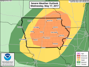
Sorry this is a short post. Parts of the state have seen severe weather the last two days including a short lived EF-0 tornado in Winneshiek County on Monday evening. I have only looked over a small amount of data but it looks like there is potentially yet another round to come through the state this afternoon & evening. The SPC is currently highlighting part of the state for an Enhanced risk of severe storms with all modes possible (see graphic). I’ll try to make another post later with an update but we shall see, otherwise check for the latest on the Iowa Weather Network website or the website of your local NWS office.
 T
T
In a case of strange timing, we just released a newly redesigned website this week as well.