Winter Storm 2/19-20
Today
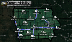
Okay so today we have a Wind Advisory going into effect at 9 AM until 2 PM this afternoon for a good chunk of the state for sustained winds of 30 MPH with gusts up to 45 MPH. We also have a Dense Fog Advisory for east central Iowa until 10 AM.
Monday & Tuesday
Two rounds of freezing rain will move through the state with some areas seeing around a tenth of an inch, while others may see more significant icing with accumulations of around a quarter to half of an inch, potentially resulting in power outages and tree damage. The areas with the greatest icing potential have had Winter Storm Watches posted. More details will be coming later today.
Current Advisories by County
Monona, Woodbury, Plymouth, Sioux – Winter Weather Advisory from 12 AM to 12 PM Monday
Osceola, Dickinson, O’Brien, Clay, Cherokee, Buena Vista, Ida – Wind Advisory from 9 AM to 2 PM Today, Winter Weather Advisory from 12 AM tonight to 12 PM Monday
Emmet, Kossuth, Winnebago, Worth, Palo Alto, Hancock, Cerro Gordo, Pocahontas, Humboldt, Wright, Franklin, Sac, Calhoun, Webster, Hamilton, Crawford, Carroll, Greene, Boone, Audubon, Guthrie – Wind Advisory from 9 AM to 2 PM Today, Winter Weather Advisory from 12 AM tonight until 3PM Monday
Butler, Bremer, Hardin, Grundy, Black Hawk, Story, Marshall, Dallas, Polk, Jasper, Madison, Warren, Union, Clarke, Ringgold, Decatur – Wind Advisory from 9 AM to 2 PM Today, Winter Storm Watch from Monday Evening to Tuesday Morning
Tama, Poweshiek, Marion, Lucas – Winter Storm Watch from Monday Evening to Tuesday Morning
Mitchell, Floyd – Wind Advisory from 9 AM this morning to 3PM this afternoon, Winter Weather Advisory from 12 AM tonight to 6 PM Tuesday
Howard, Winneshiek, Chickasaw – Wind Advisory from 9 AM this morning to 3PM this afternoon, Winter Storm Watch from Monday Morning through Tuesday Afternoon
Allamakee, Fayette, Clayton – Winter Storm Watch from Monday Afternoon through Tuesday Afternoon