On Snowfall Click-bait “Forecasts”
Another winter, another season of people posting click-bait snowfall “forecasts” on Facebook. I use the term forecast extremely loosely, as its usually little more than a JPEG of the output of one run of one computer model.
I saw a post this morning (I suspect the same one Ed Wilson was referring to during the news) suggesting the possibility of something like 40″ of snow across the area next week. There are multiple things wrong with this.
First, simply from a timing perspective, it’s a week away so a whole lot of variables will change. Sure we could get snow, it could also end up in Canada or bring rain/thunderstorms to the Gulf Coast, if it makes it here at all. Anything is possible at this point. The GFS has popped up systems like this, although not to this extreme, in the 7-14 day range multiple times since before Thanksgiving if I’m not mistaken, but we have yet for any of them to materialize.
Second, receiving 40″ of snow is highly unlikely in any event as that is more snow than Des Moines has seen in a month, let alone one day. The record for snowiest month stands at 37.0″ and dates back to January 1886. That’s 130 years. The record for a single day is 19.8″ which has stood since January 1942.
Moral of the story (TL;DR): Don’t believe snowfall forecasts more than a couple days out from the event. Anything beyond that is throwing darts at a map.
Hello November
So as usual I’m terrible at keeping things updated. I downsized two servers to save a few bucks but also tried to tweak them to work better, so hopefully the pages here load faster now. I’ve slowly been working on getting my weather-related uploads to the site switched from FTP to something more secure, or at least as many of them as I can anyway.
The company I host my servers on has been doing some upgrading of their own according to their blog including new fiber & routers, which could allow for some interesting setups in the future.
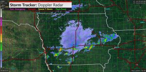
Weather has been pretty quiet and things look to be winding down…then again I didn’t expect the radar to look like this yesterday:
That’s all for now.
Today’s Forecast: HOT
As you can see it’s pretty much hot everywhere with an Excessive Heat Warning in effect for much of the region. The warning running through 7 PM Saturday for the central third of Iowa and portions of eastern Iowa, and through 8 PM Friday in southwest Iowa.
Overnight Storms, Weather Wire
Not much to report weather wise lately other than a couple back-to-back nights of storms with heavy rain, I dumped about 2.7″ out of the gauge at the house this afternoon. Looks like there might be a chance for some more yet this morning, but probably mainly north of US 30 by radar trends so far. Most of the wind damage seemed to stay north of my area, although a fair amount of damage was reported around Fort Dodge and Eagle Grove.
With the NWS apparently looking to discontinue the EMWIN ByteBlaster feed, I’ve had to look into an alternate method of feeding my weather alerting software. Fortunately, the new NWS Weather Wire is free and supported by my software (Weather Message), after purchasing the necessary addon. I have a couple other programs that are fed from the ByteBlaster feed that I have yet to figure out how to feed. Fortunately the feed doesn’t appear to be going away until the end of the year.
Quick post – stay tuned
Just a quick post this morning..
After a few storms made their way through the state yesterday the active pattern looks to continue through the week, especially tomorrow and Thursday. Hopefully I’ll have a chance to write out some more detailed thoughts later today..
Whoops
So for as far as keeping this current, I have not made a post since November. Whoops. Starting graduate school (and having to do blog posts for that) have not helped. So far there has not been much in the way of severe weather in this part of the state other than some marginally severe storms this week, most of the interesting stuff was across southeast and east central portions of the state earlier in March. It did however give me a chance to drag everything out into the truck to test and find some flaws in my video setup which I will hopefully have resolved before I really get to chase anything. I have not yet looked at models today but based on the NWS forecast there is not anything in the immediate future at least.
Happy Thanksgiving
Happy Thanksgiving everyone.
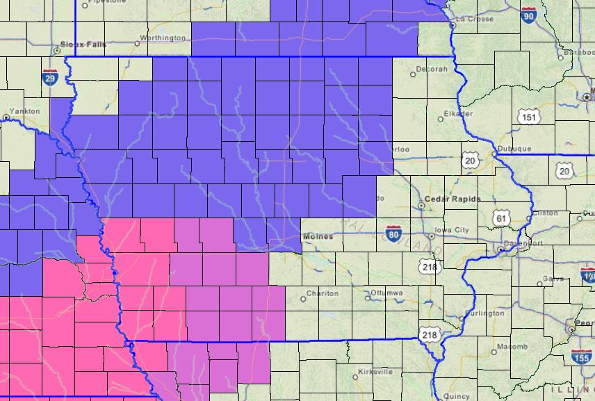
If you are traveling today please be very careful as roads are beginning to deteriorate in northwest Iowa and are currently expected to continue to do so across much of the state today as the latest round of winter weather moves through the state.
Current Iowa Road Conditions as of approximately 7:55 AM today (Thursday 11/26)
Latest conditions are available at the Iowa 511 website

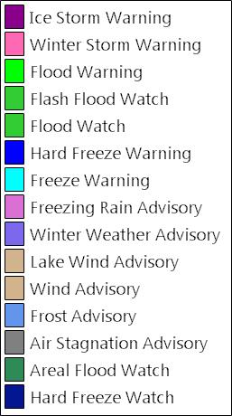
A number of winter weather bulletins are in effect as well including a Winter Storm Warning for portions of SW Iowa and SE Nebraska including the Omaha/Council Bluffs metro area.
Tornado Watch in Effect Today
The Storm Prediction Center has issued a Tornado Watch until 6 PM tonight for much of Iowa, roughly bounded by US Highways 30 & 63. See the map below.

Dry Weather Continues (For Now?), Burn Bans in Effect
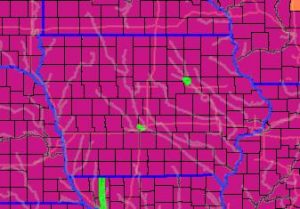
Most of Iowa has seen little in the way of rainfall so far this month resulting in very dry conditions across the state, which has contributed to a number of wildfires. As a result, fire departments in about two dozen Iowa counties have issued bans on open burning. With rain in the forecast later this week conditions should improve.
Burn bans are currently in effect in the following counties: Webster, Winnebago, Hancock, Wright, Worth, Cerro Gordo, Franklin, Hardin, Mitchell, Floyd, Butler, Howard, Chickasaw, Bremer, Fayette, Buchanan, Linn, Delaware, Dubuque, Jackson, Clinton, Scott, Mahaska, and Wapello.
Update & Severe Wx Possible Later Today..
Unfortunately with my Texas trip in April and job changes and everything I haven’t been great about keeping this current. I neglected to write up my chase log from last month as well, however seeing as how I don’t think I got any pictures its all moot. Hopefully I can keep up with things better going forward.
Fast forward to later this afternoon, we’re looking at a Enhanced risk for severe weather across central and Eastern Iowa and the remainder of the state in a elevated risk. All modes of severe weather are possible. Henry has a detailed writeup over at Iowa Weather Network. Hopefully I’ll have further details to follow later today.